‘This is it.’
In March 1980, Washington’s Mount St. Helens rumbled awake. A series of earthquakes signalled the start of something big, and scientists descended on the mountain to try to predict when, and how bad, the eruption might be.
Among them was 30-year-old volcanologist David A. Johnston, who called the volcano a “keg of dynamite,” and warned the public to keep their distance. Two months later when the volcano blasted sideways, Johnston was at a scientific observation post in its direct path. “This is it,” he radioed to his colleagues, before being engulfed in hot ash.
Today, the Johnston Ridge Observatory sits very close to where Johnston died, offering visitors a much different view of the mountain, plus exhibits and displays explaining the geologic and human history of this powerful place.
43 years after the catastrophic eruption, we’ve learned a lot about how volcanos work, how land recovers and how humans respond in a crisis. And all of that knowledge is on display near Mount St. Helens — making it the perfect destination for a weekend away.
READ MORE: Waterfalls, not wildflowers are Mt. Rainier National Park’s main springtime attraction
From sea to summit, the story of a mountain
Mount St. Helens is still the most active volcano in the Pacific Northwest and it has puffed steam, ash and lava as recently as 2008. But it is also a well-studied volcano, meaning scientists are better able to detect warning signs of an eruption — and tourists are generally safe to visit and explore.
The perfect way to do that is along the Spirit Lake Memorial Highway, which winds its way from I-5 to the Johnston Ridge Observatory, passing museums, points of interest and hiking trails along the way.
Traveller’s Note: In May 2023 a landslide closed the highway near Milepost 43, just prior to the Johnston Ridge Observatory. As of this writing, the Coldwater Lake Recreation Area and Johnston Ridge Observatory are inaccessible, and closed indefinitely.
Mile 0 – Castle Rock
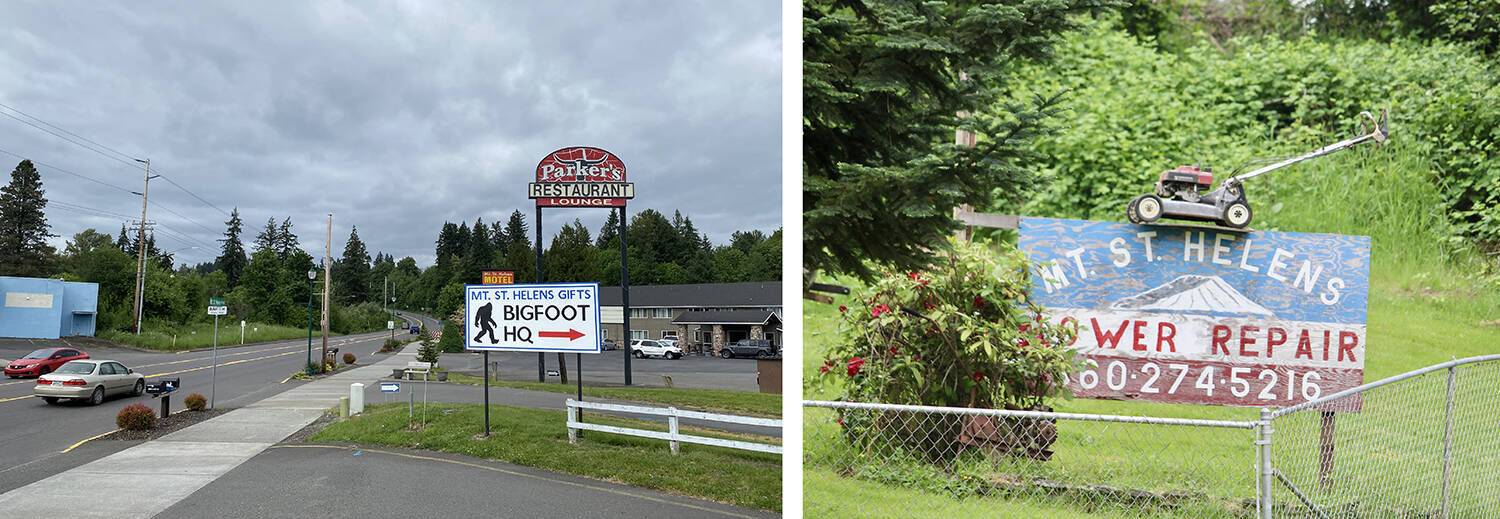
The second you pull off I-5 and point your car east, you’ll be greeted with a kitschy collection of signs, shops, hotels and restaurants paying tribute to the volcano (and Sasquatch, because why not?). Take a selfie with a Mount St. Helens road sign, pick up a souvenir t-shirt and grab a bite to eat.
Mile 5 – Mount St. Helens Visitor Center and Seaquest State Park
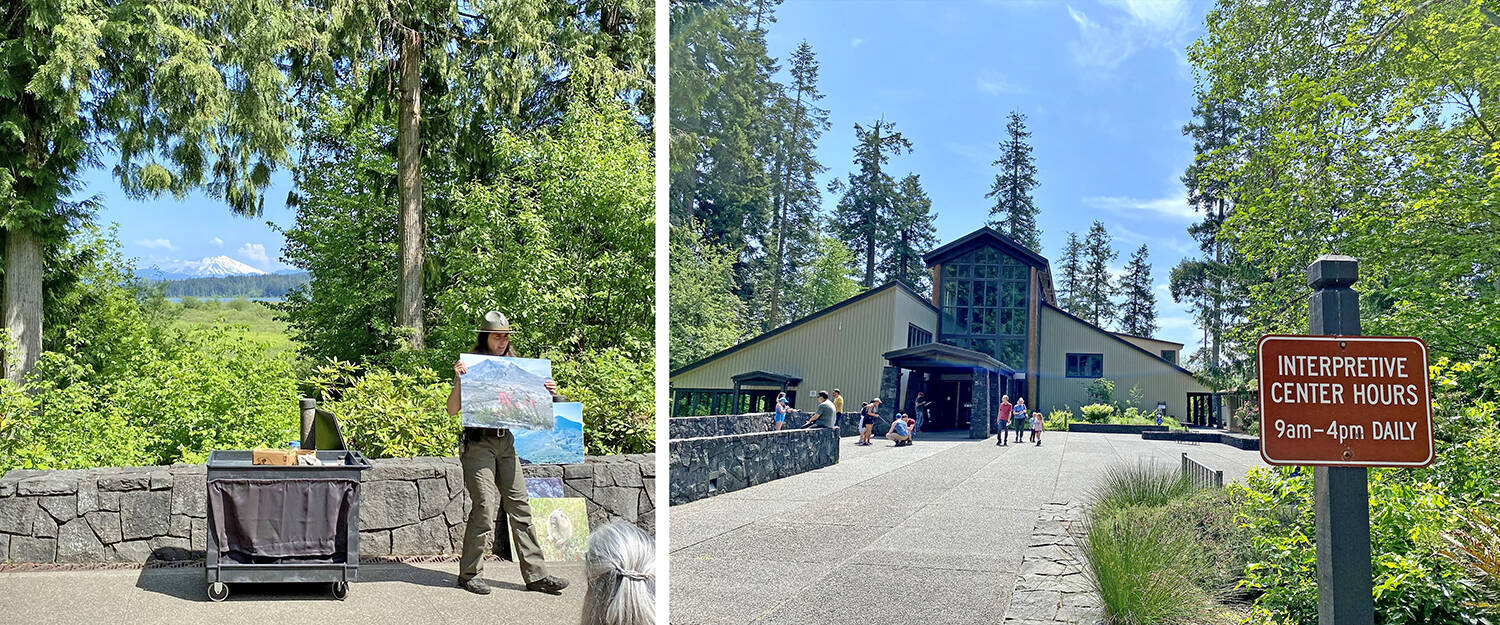
If you didn’t book a motel room in Castle Rock or a bed in a lodge further up the road, Seaquest State Park’s campground is a great place to set up base camp for a few days of exploring. It’s an easy walk under the highway to the Mount St. Helens Visitor Center, where you can soak up the history of the volcano from prehistoric times to modern day.
Displays appeal to a wide range of ages and interests, with a walk-through volcano complete with glowing lava for the kids, plus geology, Indigenous history and a day-by-day account of the months leading up to the 1980 eruption for older visitors. Flip through pages of the Pulitzer Prize-winning coverage from local media, then watch a documentary with powerful footage of the blast and the people affected by it.
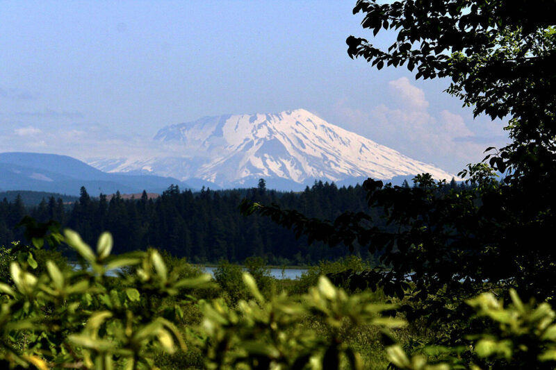
If you’re lucky to visit on a clear day, outside you’ll catch your first glimpse of the mountain, framed thoughtfully by pruned trees near the entrance to the Visitor Center.
Mile 19 – North Fork Survivor’s buried A-frame
When Mount St. Helens erupted, it shot a plume of ash into the atmosphere (after two weeks the ash encircled the globe, inspiring the bumper sticker Don’t come to Washington, let us come to you!). An earthquake also triggered a massive landslide, sending a cement-like mix of ash, mud and debris downstream. About eight hours after the eruption, that mudflow engulfed an A-Frame home, which was left to stand as a monument to the destruction.
Owners of the A-frame also collected vehicles damaged by the blast, sharing stories of some of the approximately 55 people who died that day. “The common misconception is that the victims of the eruption were in areas they should not have been,” a sign reads, but only six of the volcano’s victims were actually in the restricted ‘red zone’ on the day of blast.
Among them were volcanologist David Johnston and 84-year-old Mount St. Helens Lodge owner Harry S. Truman, who refused to leave, but other victims were in the ‘blue zone,’ a line drawn after discussions between science, industry and government.
Even as a bulge on the side of the volcano grew by an alarming five feet each day, many wanted to get closer. News reporters and tourists camped out at road blocks. Just a day before the eruption, evacuated residents had been allowed back to their homes inside the red zone to pick up belongings; another trip was scheduled for the day of the blast. The wrecked cars and buried A-frame hint at the likely fate of many who stood too close.
While the site at Mile 19 is the least-polished point of interest along Spirit Lake Highway, it may be the most poignant. It’s not hard to put yourself in the shoes of those who died in the blast, or to imagine how modern society would react to a similar event.
READ MORE: Unique Tofino hike offers crash course in Second World War history
Mile 22 – Sediment Retention Structure
A short forest hike brings you to a dam built after the eruption, designed to stop sediment from flooding towns and choking rivers downstream. Interpretive signs help you understand the scale of destruction and recovery efforts — in the first seven years, enough sediment was dredged from rivers to build a 12-lane highway, one foot thick, from New York to San Francisco.
Mile 30 – Hoffstadt Creek Bridge
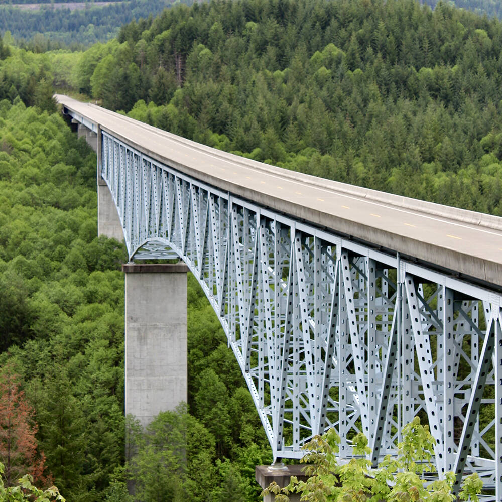
Pull off the highway for a picturesque view of Hoffstadt Creek Bridge, which holds a ribbon of highway an impressive 370 feet over the canyon floor. The trellis bridge also marks the edge of the 1980 blast zone, 14.8 miles from the crater.
Mile 33 – Forest Learning Center
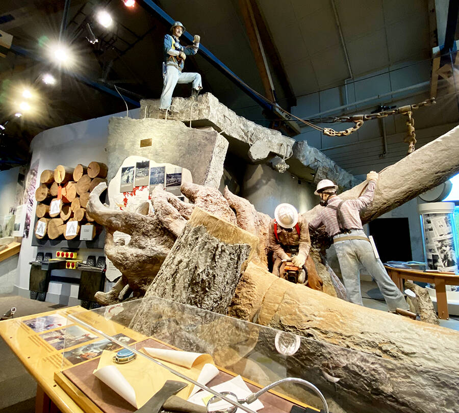
You’ll find more of the human story of the 1980 eruption at the Forest Learning Center, plus an emphasis on Weyerhaeuser’s reclamation and reforestation efforts after the blast. Millions of trees were blown over and loggers salvaged many — though ash-covered bark was quick to dull chainsaws. Tree planters then moved in, and after 40 years, some of those seedlings have already been harvested.
The Center is perched on a cliffside with great views of Mount St. Helens and the valley below. If you’re lucky, you may spot a herd of elk — elk have thrived in the wildflower-rich blast zone in the years since the eruption.
Mile 37 – Elk Rock Viewpoint and Mile 41 – Castle Lake Viewpoint
Both of these highway pull-outs offer spectacular views of the volcano and the scarred landscape inside the blast zone, plus new lakes formed when the landslide overflowed Spirit Lake and rearranged terrain.
Mile 45 – Coldwater Lake Recreation Area (currently closed)
One of the lakes created by the 1980 blast, Coldwater Lake has become a popular destination for kayaking, swimming, fishing and hiking. Explore the accessible Birth of a Lake Interpretive Trail or try your luck at the longer Coldwater Lake trail to look for waterfalls and signs of elk.
Traveller’s Note: The land within the Mount St. Helens National Volcanic Monument is protected and hikers MUST stick to designated trails. These fragile ecosystems are still recovering from previous eruptions, and human interference disturbs ongoing scientific research.
Mile 52 – Johnston Ridge Observatory (currently closed)
This is the closest you can get to the crater, without applying for a climbing permit to scale the summit. Enjoy a close-up view of the crater and lava dome, explore exhibits on the geology and science of the eruption, take part in ranger-led programming, or set out on a longer hike past blown-down forest, log-filled Spirit Lake (former home of Harry Truman’s lodge) and mountain views.
Further exploration
The Spirit Lake Memorial Highway isn’t the only place to explore Mount St. Helens’ past and present. To the south, go inside lava tubes at Ape Cave or see casts of trees enveloped in lava from ancient eruptions at the Trail of Two Forests. From the east, take Forest Road 99 during the snow-free summer months to see the wrecked remains of a vehicle, Windy Ridge Interpretive Site and other viewpoints.
Plan your adventures throughout the West Coast at westcoasttraveller.com and follow us on Facebook and Instagram @thewestcoasttraveller. And for the top West Coast Travel stories of the week delivered right to your inbox, sign up for our weekly Armchair Traveller newsletter!




 Guided June hikes explore old-growth forests in seven Kootenay communities