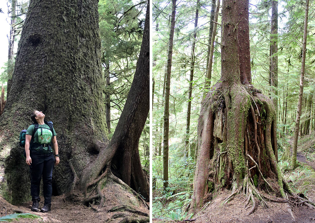
Cape Scott is so far from anything that even Vancouver Islanders say it’s a once-in-a-lifetime adventure. It’s not just that the trail is long (46km round-trip), it’s also that it’s remote — driving to the trailhead is a mission in itself. You’ll travel six hours on paved highways from Victoria to Port Hardy then another two on winding logging roads, but then you’re face-to-face with some of BC’s best beaches, lush rainforest, a hundred-year-old pioneer route and a rugged coastline dotted with sea stacks.
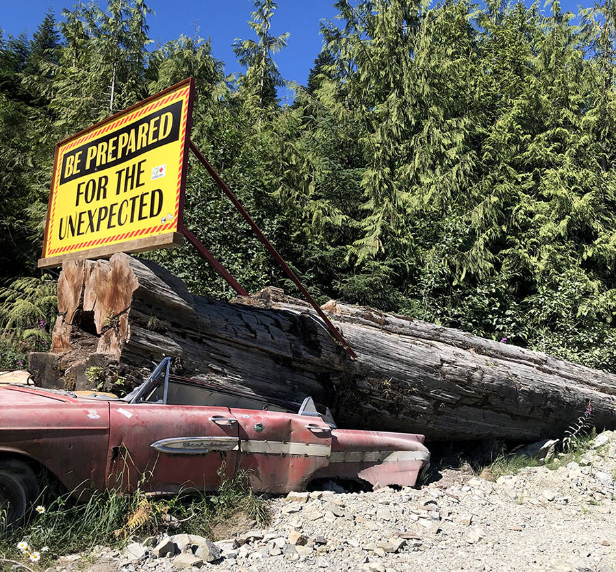
The gravel road to Cape Scott is well-marked and well-maintained with plenty of signs for first-timers, but it’s important to drive with caution. Sedans can definitely handle the graded gravel road, but you’ll have better handling in a truck or SUV. Pull over for any oncoming vehicles. Drive with your lights on, even on a sunny day. Stay to the right on all corners and hills and assume that you may encounter a loaded logging truck at any time.
Cape Scott has seen a surge in popularity, thanks in part to the pandemic encouraging people to get outside, and also thanks to Lonely Planet naming San Josef Bay “Best Wilderness Beach” in Canada. On the Saturday of a long-weekend the Cape Scott parking lot was overflowing with at least 200 cars — impressive, considering how hard it is to even get to the trailhead. But once I started hiking, the familiar quiet of the backwoods was easy to find, and the trail never felt overcrowded.
The Tlatlasikwala, Nakumgilisala and Yutlinuk lived in the area for centuries, but today’s hiking trail mostly traces the steps of European settlers. First Danes, and then other Europeans and North American settlers, came to the area in the first half of the 20th century on the invitation of the Canadian government. The pioneers found success farming and fishing, but the Canadian government failed to build the road they’d promised, so there was no easy way to transport goods to market. All of these settlements were abandoned by the end of the First World War.
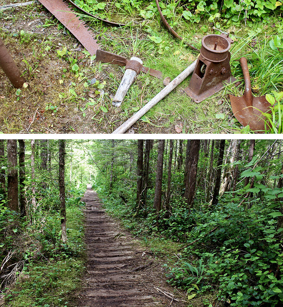
When you walk the Cape Scott Trail today you’ll find rusted wood stoves and lumber saws that were too cumbersome for pioneers to carry out when they left. You’ll walk kilometres of flat, straight corduroy road made by laying logs side-by-side. It’s not overly stimulating as far as west coast trails go, but you’ll feel an extra layer of sympathy for the pioneers who had to make this same traverse any time they needed supplies.
Some people drive all the way to Cape Scott to picnic or camp at San Josef Bay — it’s just a 45-minute walk, and there are wheelbarrows to help you transport provisions. I glanced wistfully at the San Josef Bay turnoff, then turned right for the longer (six-hour) hike to Nels Bight.
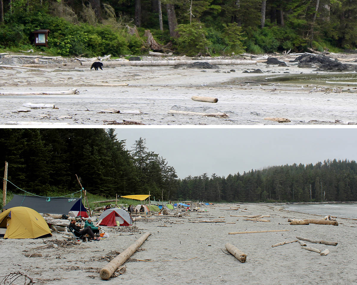
The trail is immaculately maintained by the crew from 43K Wilderness Solutions, with kilometres of sturdy boardwalk featuring nary a rotten step. Eric Lake and Fisherman River have the best supply of clear water, but even there you must purify or boil it before drinking. I was on the look-out for signs of wolves, and then just before Nels Bight a black bear loped across the trail and into the salal. It lingered at the south end of the beach all evening, but seemed content to keep its distance from the hundred-or-so tents dotting the beach. Campers, thankfully, were diligent to keep all food away from their tents, secure in the metal food caches, so the bear had no reason to dig near our tents.
The hot, dry summer meant that drinking water at Nels Bight was a small trickle of yellow water from a forest stream. In contrast, even during a heat wave most hikers were wearing fleece or down jackets by 5 p.m. to ward off the ocean mist.
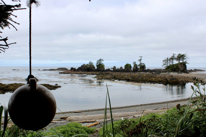
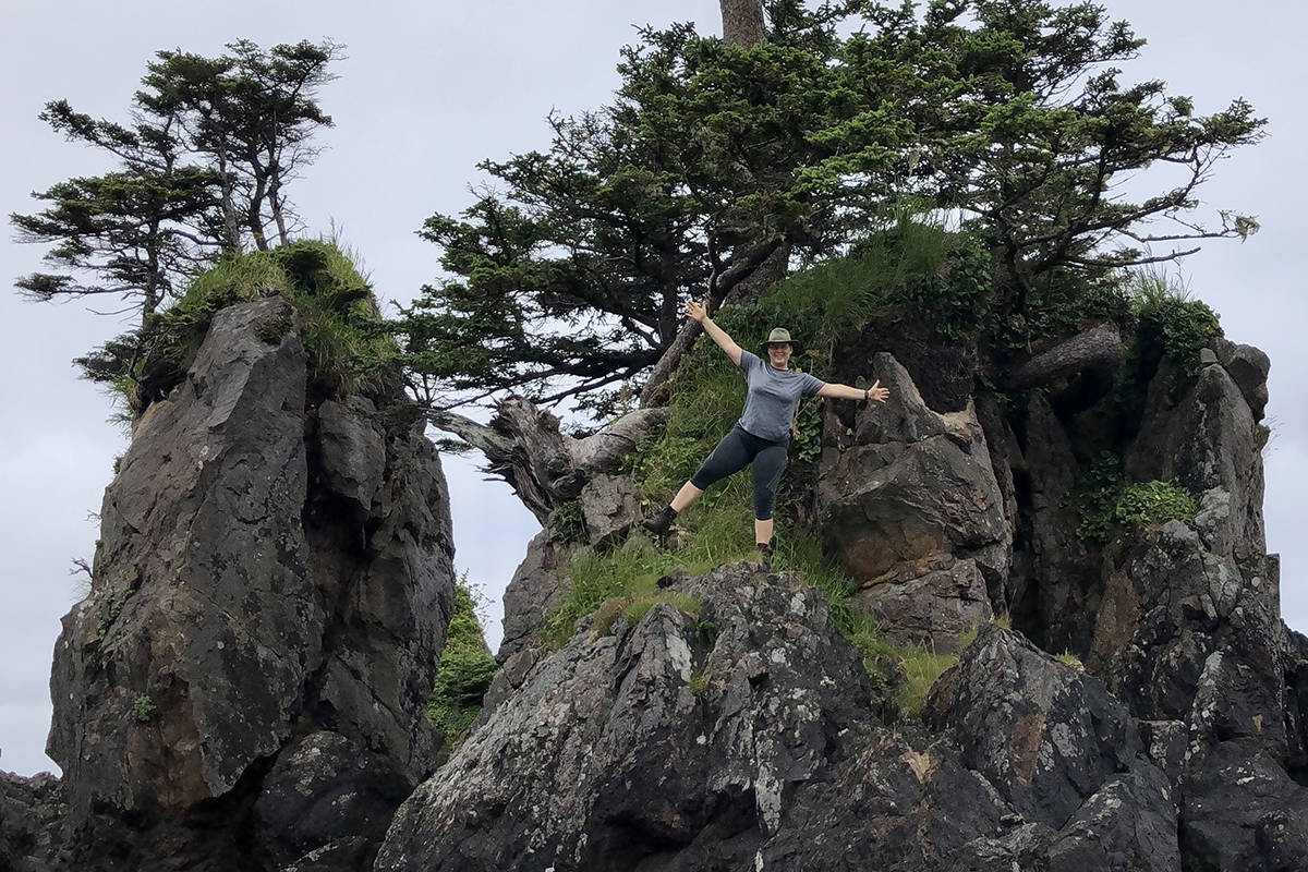
You can leave your tent at Nels Bight and pack a lunch to tackle the rest of the trail, taking in the beaches at Experiment Bight and Guise Bay before making your way to the lighthouse. Keep an eye out for the old driftwood fence line built by N. P. Jensen, who also planted clover to stabilize the sand dunes. You’ll also walk a plank road used to transport goods between outposts during the Second World War. Watch for a trail on the left side after Guise Bay, and follow a string of buoys hung in the trees to find a spectacular gravel beach with seven picturesque sea stacks.
If you have the time, it’s worth checking out Hansen Lagoon to see the impressive dikes dug by Danish farmers around the year 1900. It’s also a great spot to watch birds travelling the Pacific Flyway.
The walk to the lighthouse and back to Nels Bight takes about half a day, and most people spend the rest of Day Two lounging on the beach. But with a tight schedule I had to pack up my tent and start working my way back towards the trailhead early. Hiking a half-marathon with a heavy pack two days in a row is, shall we say, less than ideal, but definitely do-able on the mostly flat Cape Scott Trail. Having seen the sea stacks near the lighthouse I trudged all the way back to Eric Lake to camp. On the morning of Day Three I finished the trail and made the long dusty drive back to civilization.
Know before you go
- The trail has an impressive amount of boardwalk, but you should still expect wet, muddy conditions. Pack warm clothes and a raincoat, even in the middle of summer.
- There is no potable water on the trail. There are freshwater streams at all campsites, but you must bring your own water purification system.
- Camping costs $10 per person per night, paid in cash at the trailhead.
- Bring a separate bag for your food, so it’s easy to pack in and out of the bear caches at night. Plan your meals so the cooking gets easier as you go — I survived on humus and pita for the last 24 hours, because I was too exhausted to set up my stove!
- Test your tent, stove and hiking boots before you hit the trail. It’s a long way to walk if something doesn’t work.
- Don’t attempt the drive if you don’t know how to change a tire, and drive with caution.
- Download the park brochure before your hike to follow along with sites of interest.
- Happy trails!
FURTHER READING: Haida Gwaii inspires big walks, and its East Beach Trail will put you to the test.






 Craft beer in the Thompson-Okanagan: 3 Ale Trails to explore!