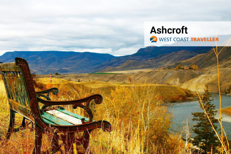
If only the hills could talk, they would fill your head with stories of the men and women who came to this area seeking their fortune.
Many came for gold, but the fur trade and ranching also enticed people here to the Ashcroft and Cache Creek regions.
From the pristine mountains and lakes of the Highland Valley Plateau to the rugged Arrowstone and Trachyte Hills bordering the Bonaparte River as it rolls past Clinton, Loon Lake, historic Hat Creek and Cache Creek, to the furrowed gulleys and fields lining the Thompson River as it flows from Kamloops Lake to Savona, Walhachin, Ashcroft, Lytton and beyond, the beauty of the Southern Interior entrances and inspires.
The natural beauty and depth of history of this area draws you in to learn more, which you can on mine tours (including some that are free!).
Learn more at ashcroftbc.ca and cachecreekvillage.com
Facts
• Thousands of miners appeared from nowhere, between 1858 and 1862, panned and dredged the waterways until they’d taken all of the colour out of them, then disappeared into the hills as they moved on to the next strike. Fortunes were made and lost, towns were built and abandoned, history forever etched in the hills and deserted trails.
• Considered one of the engineering marvels of the 19th century, the Cariboo Wagon Road was constructed during the Fraser River Gold Rush.
• There’s some amazing geocaching spots here containing everything from souvenir pins and stickers to marked coins to anything else that will fit inside the box. Discover 144 sites throughout Ashcroft, Cache Creek, Clinton, Lytton, Savona, Logan Lake, Walhachin, Lillooet and beyond!
• The Thompson-Shuswap Indigenous people first called the area Tuk Tuk Chin, but the town went through many names – Barnes Station, St. Cloud and Ashcroft Station – before settling on Ashcroft, adopting the name from the nearby property owned by the Cornwall brothers.
Ashcroft enjoys a local steppe climate, with quite cold winters and very warm summers. The annual rainfall is only about 317 mm (12.5 inches).
Destination BC is developing a new campaign to promote hyper-local travel where residents are “tourists-in-their own hometown,” while practising the COVID-19 safety protocols as recommended by the B.C. Provincial Health Officer. Many B.C. parks are now open, and national parks were to open as of June 1.
(Check this website for current details on travel.)
Getting Here
Driving: Travelling the Trans-Canada Highway 1, Ashcroft is located 93km (58 mi) west of Kamloops and 338 km (210 mi) northeast of Vancouver.
Flying: The closest scheduled air service is at Kamloops Airport with flights to Vancouver, Calgary and Prince George.
Dream now, travel later. To plan for future adventures here and throughout the West Coast, visit westcoasttraveller.com







 Discover Creston, BC